Aerial Surveying & Inspections
Our state-of-the-art UAVs deliver land, building and roof inspections, providing our clients with a cost-effective, high-quality option that avoids the risk of operating at height associated with traditional survey techniques.
Creating a Safer Surveying Method
Minimising the risk of working at height whilst capturing high quality, referenceable data.
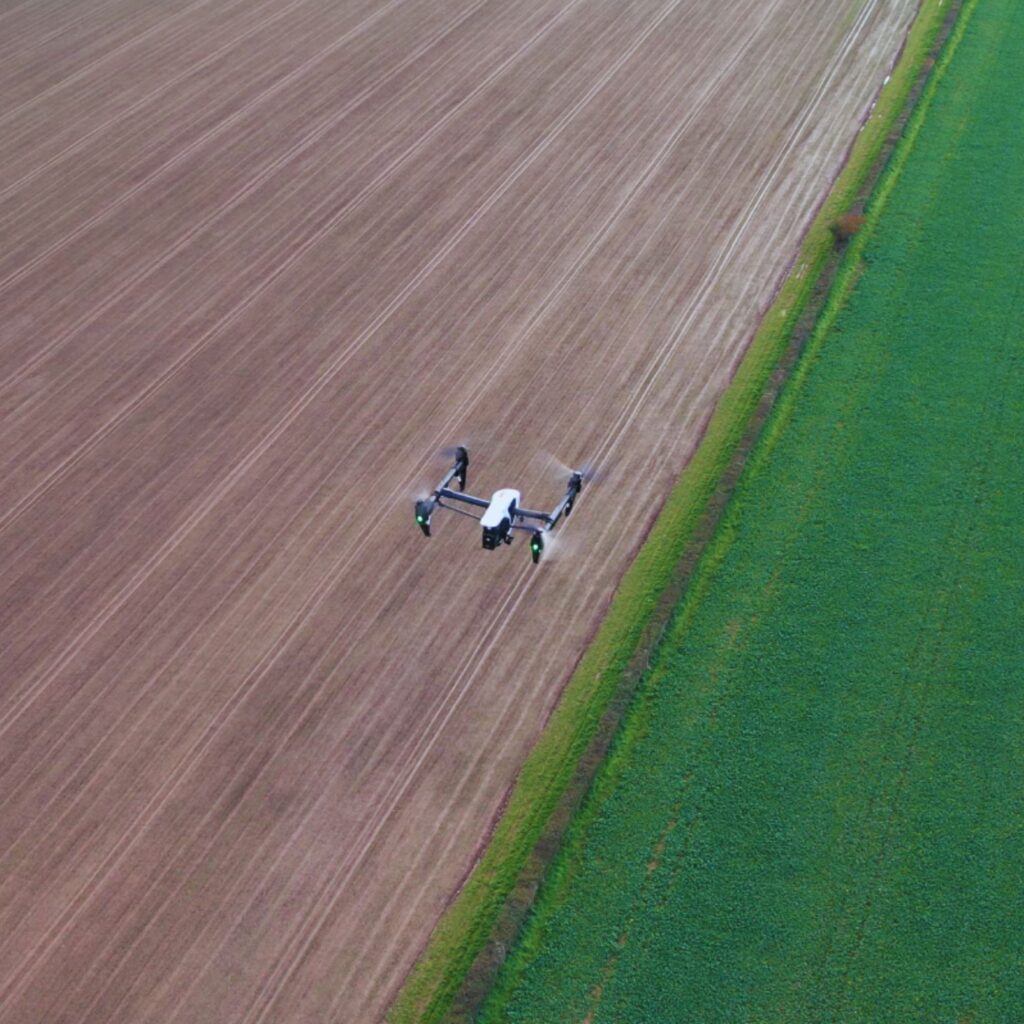
JRNVisuals has the technology and knowledge to reach even the most inhospitable, dangerous, and inaccessible locations. Our specialized aerial survey methods enable us to effectively analyse a location that is thought inaccessible by foot or vehicle, giving you a thorough picture of the situation. Our aerial surveys enable access to tough places that you require information on, whether we deploy a helicopter or cutting-edge drone technology. We have the capabilities to conduct aerial surveys that collect high-resolution imagery and detailed survey data as we have a team of experienced drone pilots who cover multiple areas.
Development & Monitoring
Observing a project’s progress as it moves through each phase to maximise site efficiency and stakeholder management.
Planning & Design
The work involved designing or building a site, and the surveying required on the piece of land or existing buildings in question.
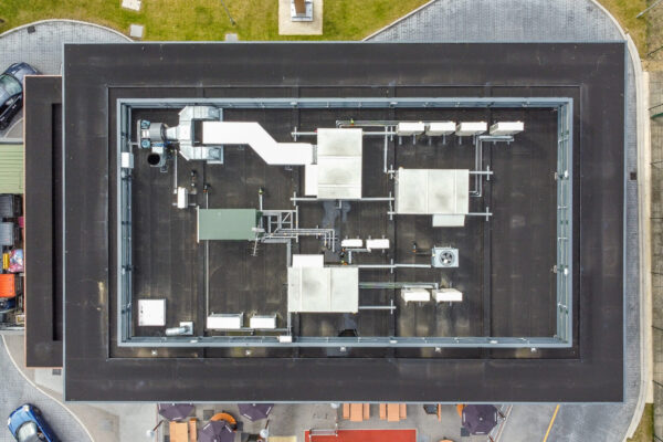
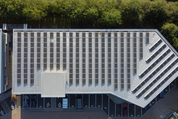
Maintenance & Inspection
Providing an ongoing preventative or corrective inspection to plant and buildings, in order to monitor and enhance their operational lifespans.
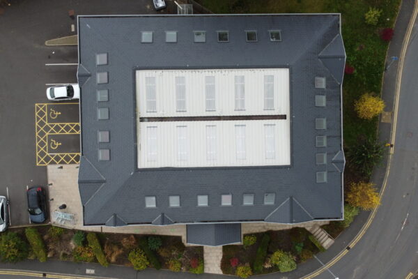
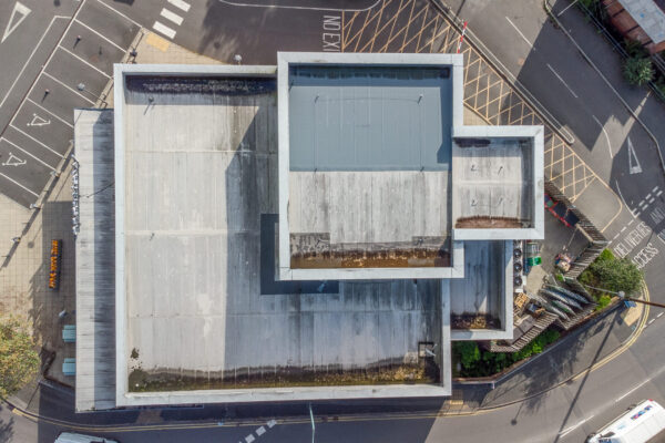
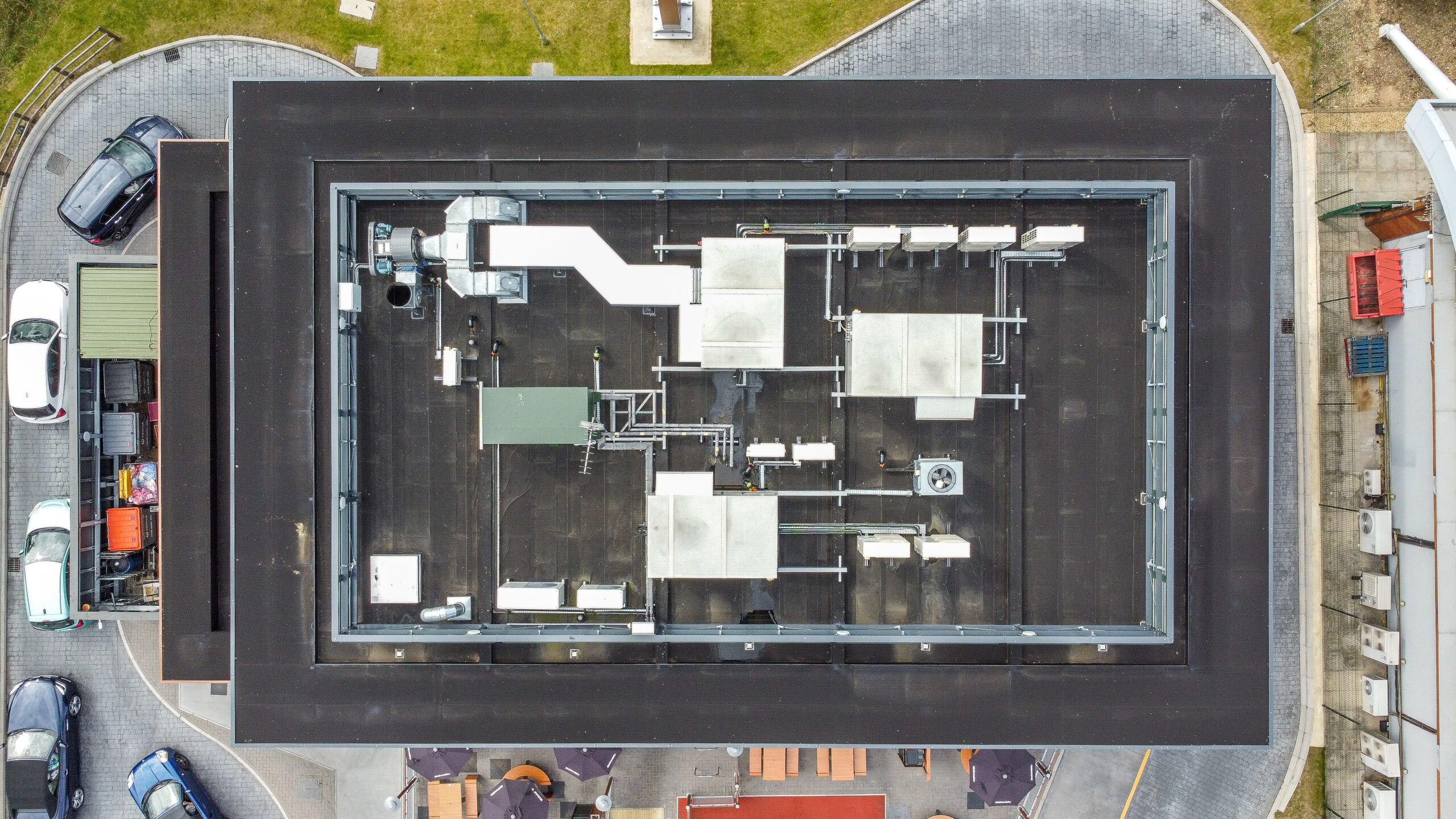
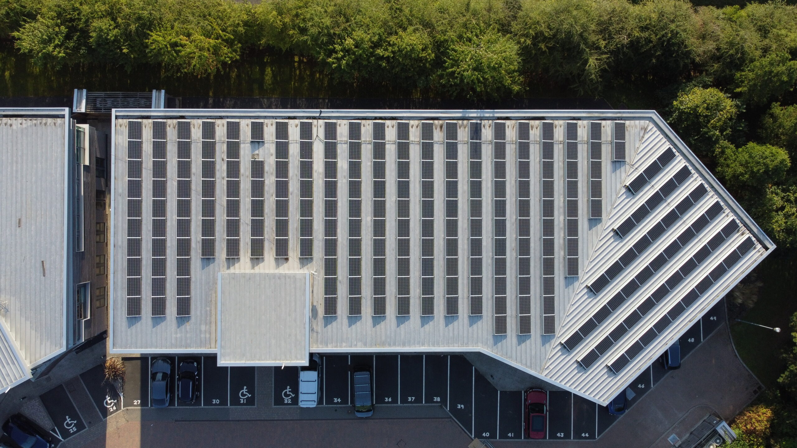
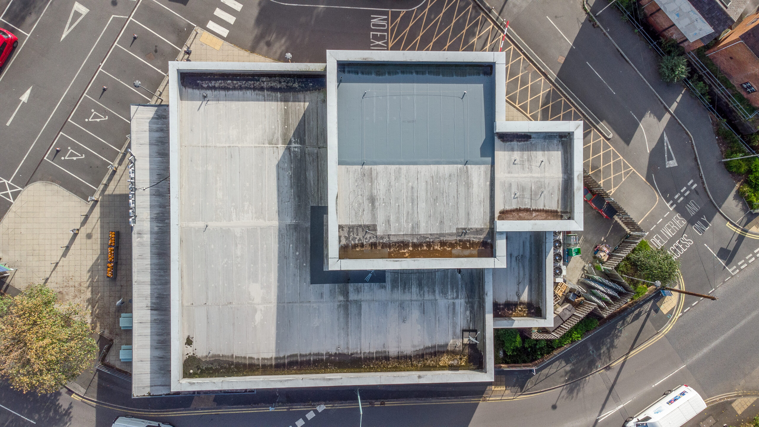
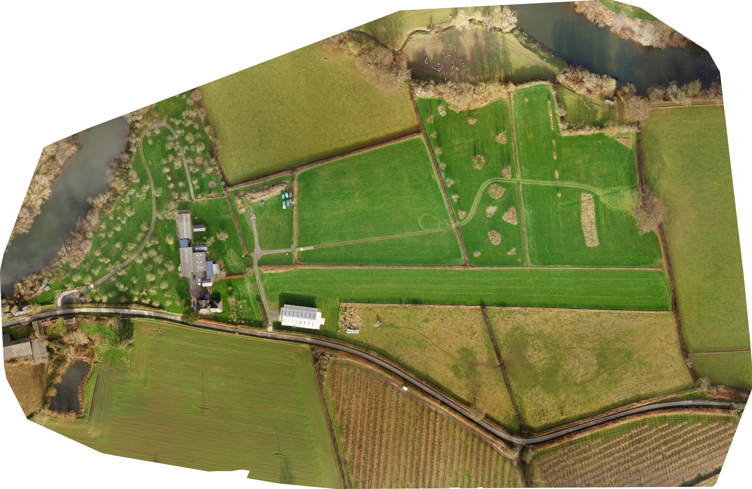
Featured Surveys
High Quality Referenceable Data
Our team of skilled drone pilots are always looking for new and innovative methods to carry out their work, and we are now able to offer the use of unmanned aerial vehicles (UAVs) or drones for surveying and inspection. The ability to ‘see’ a structure up close without the requirement for human entry is the main advantage of deploying a drone for inspection. This improves both the safety and the speed with which the work can be done.
With a quick turnaround time, we can deliver accurate and relevant datasets. Drone surveys are very effective for large-scale sites with a lot of elements to look for and a lot of information to collect.
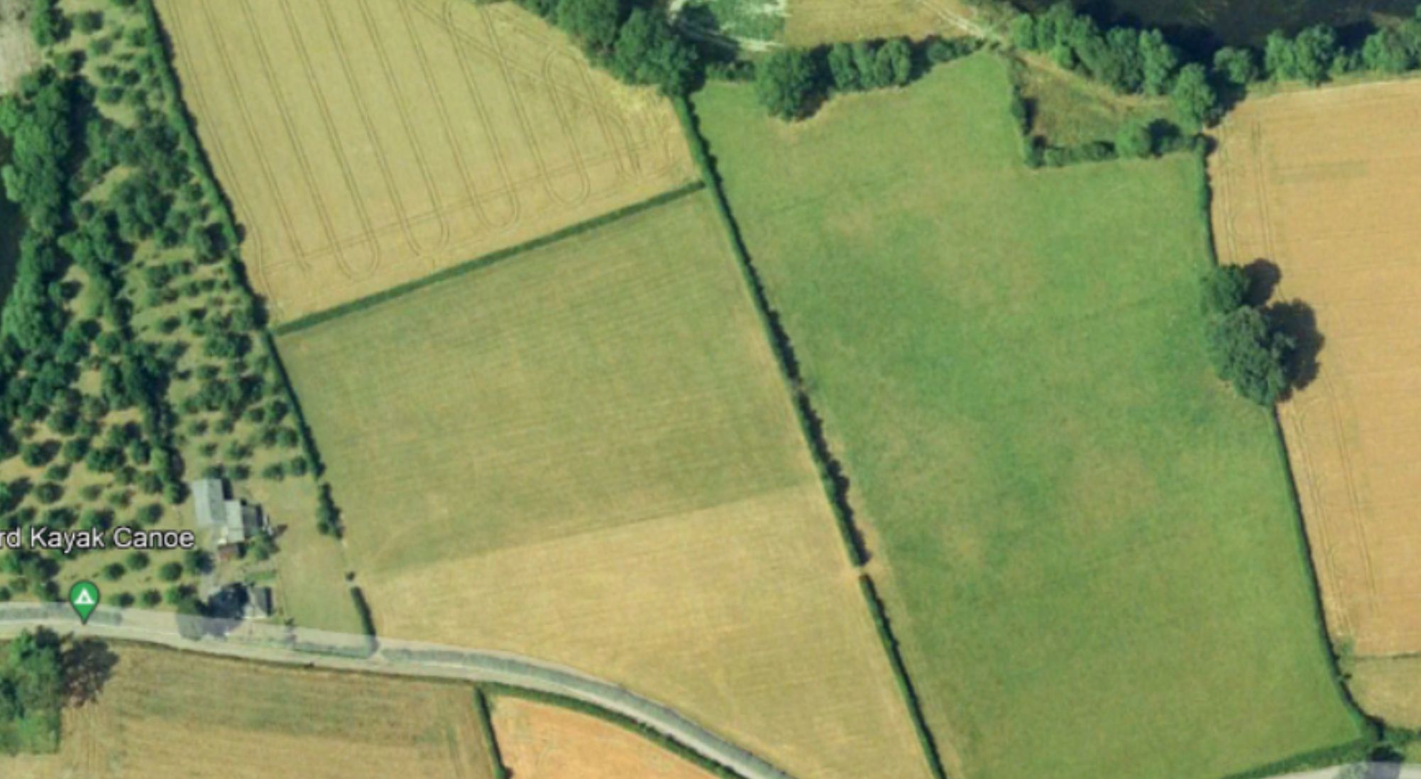
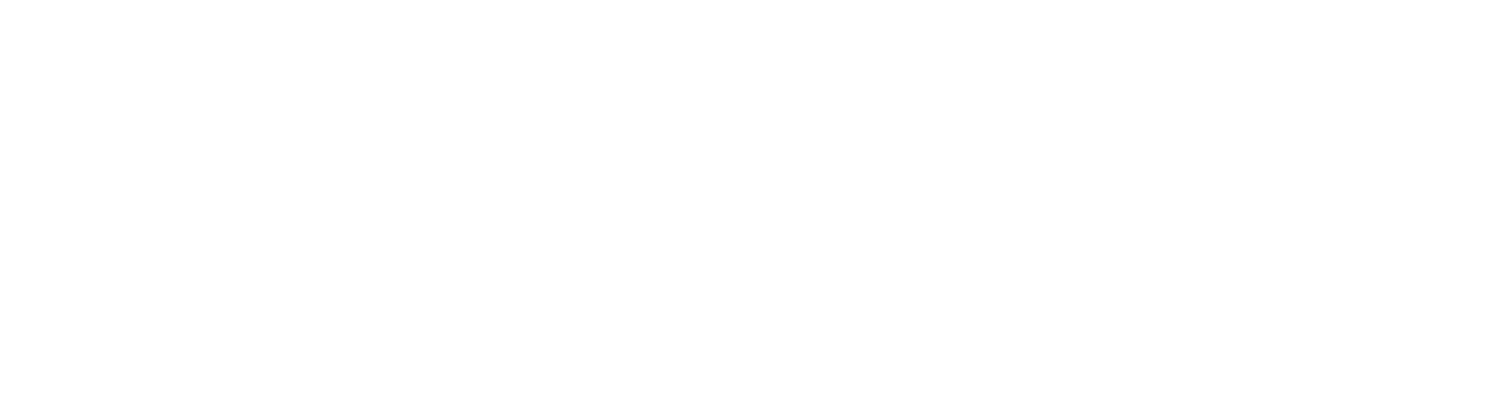
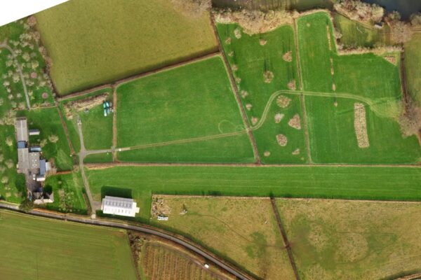
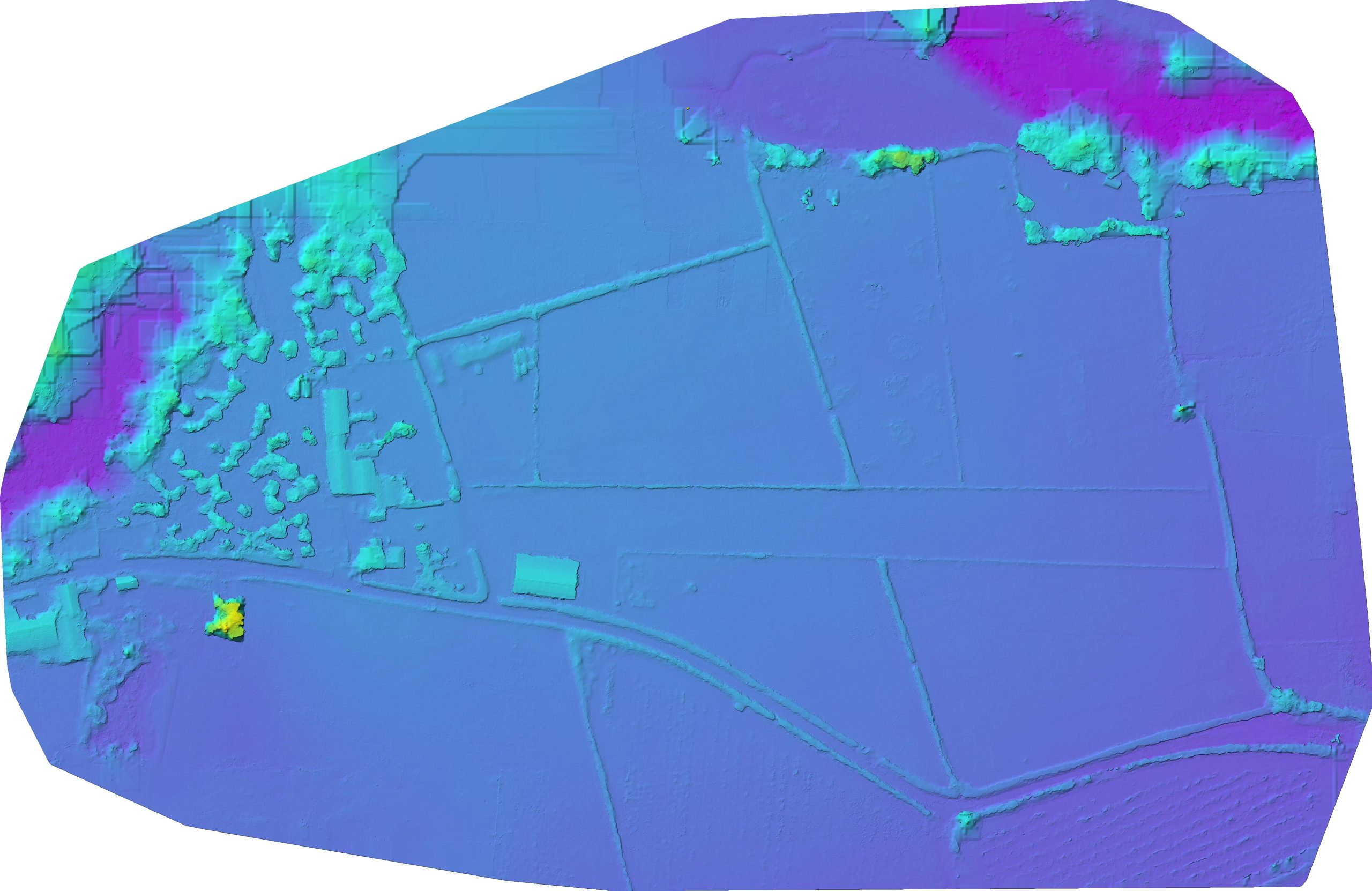
(Images showing a side by side comparison. (Left) showing out of date satellite imagery. (Right) showing a land survey recently completed with referenceable landmarks).
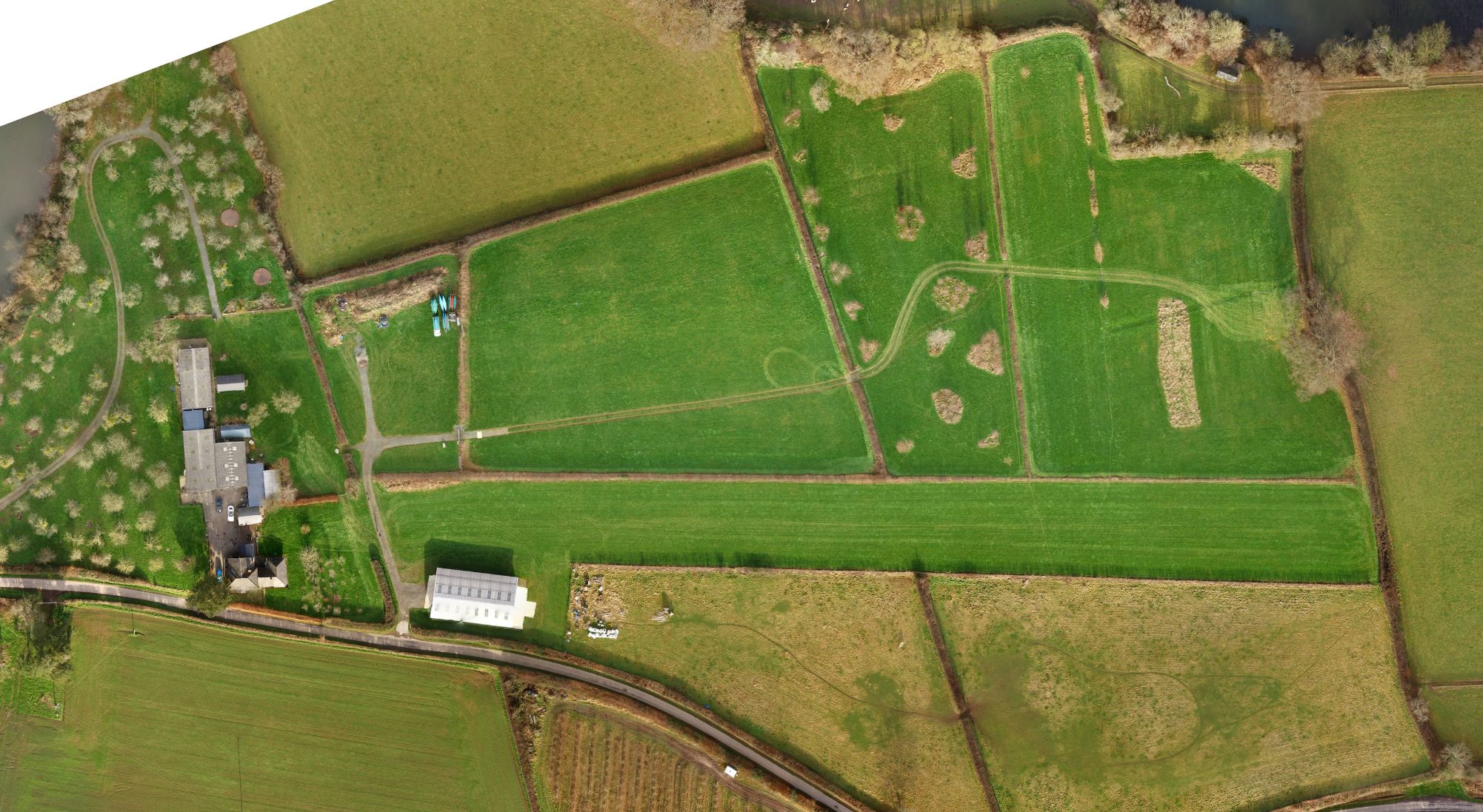
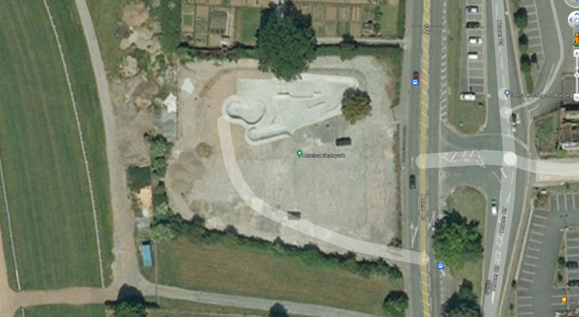
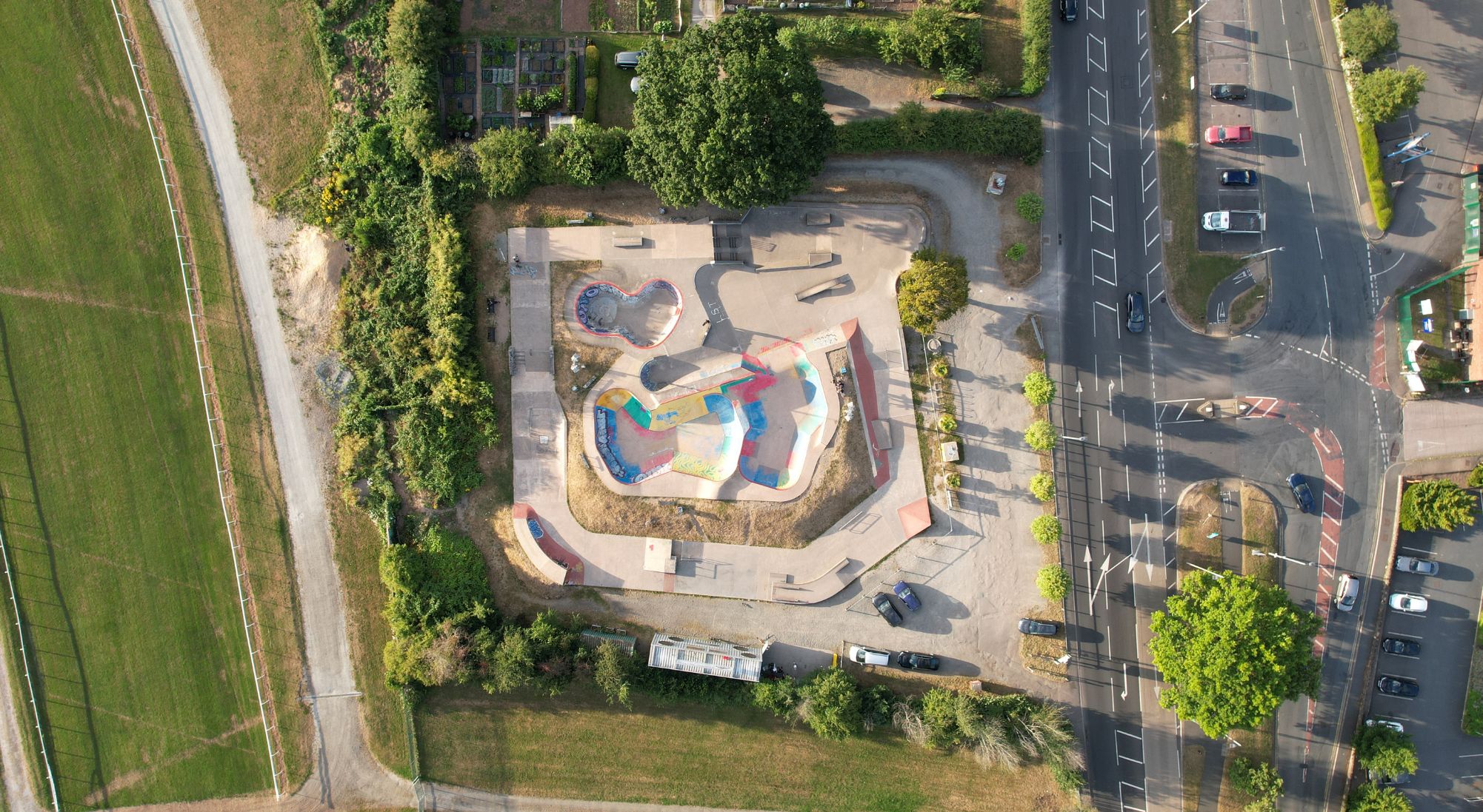
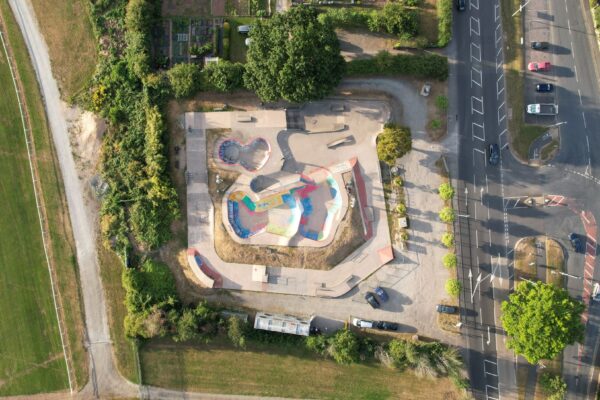
Case Study
Land survey to assist planning stages for a £500,000 site expansion in Herefordshire.
Hereford Skatepark approached JRNVisuals to complete a site survey showing the site boundary and surrounding area. The images captured will be used to help Wheeled Sports 4 Hereford Ltd give designers an idea of the site layout for the new proposed expansion.
WS4H are working towards securing funding of around £500,000 as part of the Stronger Hereford campaign which has brought £22.4m into the city for regeneration projects. The funds will be used to improve the skatepark facility, nearly doubling in size.
Why Choose JRNVisuals
Timescales
Every construction project depends on time, so we always strive to maintain our turnaround times as short as possible. To keep your project rolling, we also provide a “Next Day” service and 24-hour survey downloads.
Coverage
We are able to work on projects of any size across the UK from our location in the Midlands. Therefore, we can reach you wherever you are!
Peace of Mind
We carry suitable levels Professional Indemnity and Public Liability insurance. Our fully trained team of drone pilots are also DBS/CRB checked.


Benefits of Aerial Surveys
Minimal Disruption
Short setup time and smaller cordoned area for drone take off and landing.
Risk Mitigation
Reduces the risk of fall and injury at work. Obviates the risk of working at height.
Cost Effective
Simply a drone and a pilot! No requirement for cherry pickers and the erection of scaffolding.
Referenceable Data
High quality image data which is shown real-time to the pilot and to a customer representative and is then delivered digitally.
Business as Usual
Your estate can operate as normal as only a minimal separation distance is required for safe drone operation.
Flexibility
Real time imagery allows customer representatives to identify any areas of particular interest.
Frequently Asked Questions
What UK geographical area does JRNVisuals cover?
From our Midlands base in Herefordshire, we are conveniently located for aerial drone photography, filming & inspections across the North, East South and West of England. Our rates are attractive enough for clients further afield across the rest of the United Kingdom to consider hiring JRNVisuals (particularly those located close by in Birmingham, Manchester, Liverpool, Cardiff, Bristol, London, Carlisle and many more).
Can JRNVisuals fly near airports or in other restricted locations?
Yes, JRNVisuals are able to liaise with local air traffic control (ATC) to organise permission to operate close to airports.
How long do JRNVisuals drones fly for?
The length of a typical flight varies from 25 to 30 minutes depending on the payload, wind, and weather.
Can JRNVisuals fly in built up areas?
Yes, as long as we abide by the CAA’s laws and regulations and the risk assessment finds it to be safe to operate. If we are working in a confined space, such as a TV or movie set, and everyone we are working with has been briefed on the flying procedures, we are allowed to fly closer as long as the pilot is certain that it is safe to do so.
Can JRNVisuals fly outside of the UK?
Yes we do. However unmanned aerial vehicle (UAV) flying rules and regulations vary from country to country. Please contact us to discuss you requirements.
Do you hire your drones to third parties?
No – We only hire our drones along with our own skilled and qualified pilot.
Each of our UAV’s (unmanned aerial vehicles) are registered with the CAA and each pilot needs to be certified and licensed by the CAA.